Technology has come a long way since the old days of topography maps.
More often than not during my 4WD travels I will carry topographic maps as a backup to today’s modern GPS mapping devices but very rarely do I crack the old map folder out unless the electronic maps don’t show a track that I’m looking at.
Even with all these maps and GPS devices hand held and otherwise I like nothing more than using Google Earth to plan my shoots.
Google Earth can be used as a stand alone application installed on your PC/Mac/iPad/Android device or used as a browser plug-in with Google Maps which is my preference.
Currently I’m sitting in my hotel room here in Bali with my lovely wife and two young children. As I have been kindly reminded, we are on a family holiday, not a Photography Expedition, so my time to myself in the field is extremely limited and there is where Google Earth comes into play.
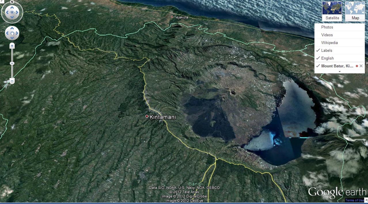
A quick dash over to Google Maps and typing in the name of the place I’m intending to shoot at “Mount Batur” nets me a quick result. 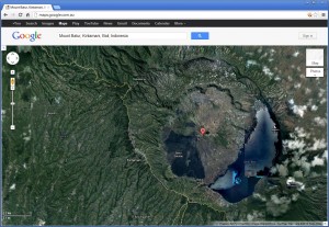 A top down view of Mount Batur with amazing clarity. Obviously the more remote the wilderness location the likelihood of amazing satellite imagery declines exponentially.
By selecting the icon for Google Earth mode things get a little more amazing.
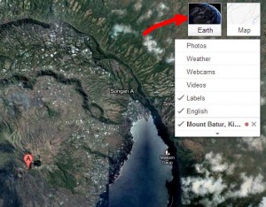
(Please note, if you haven’t installed the Google Earth Plug-in for your browser you will be asked to do so. This will require a re-start of your browser and subsequent re-searching for your location)
Apart from the normal North South East West Navigation found in Google Maps we are now presented with the ‘look around’ navigation controls and of course a 3D view. The 3D model seems to be a simple rendering of the Satellite images over a topographic profile. So if there was cloud cover covering your location of choice, sadly the clouds will plague you still.
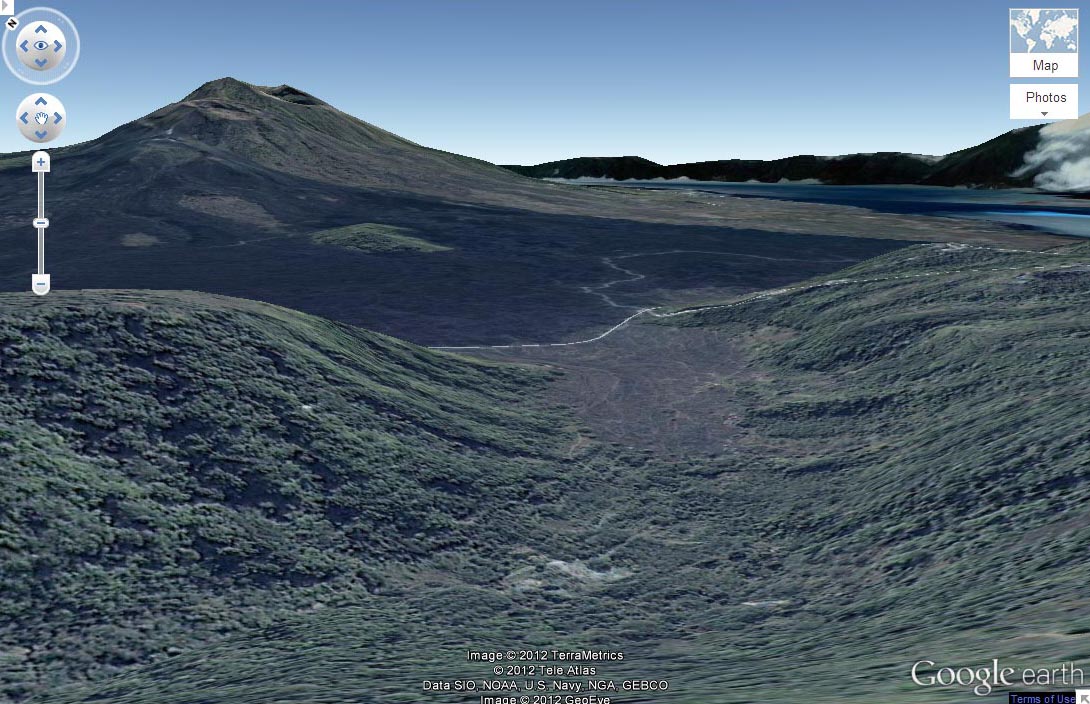
With some navigating, zooming, rotating and some changes in perspective just using my track pad whilst relaxing with the kids I was able to find a nice perspective of Mt. Batur. In all honesty I found a number of locations to photograph this volcano over a period of 15-30 minutes but this was the first location the I found and screen snapped for this post.
The next day after exploring Mt. Batur and its regions via Google Earth, I booked in for a 40 kilometre bicycle ride starting at Kintamani, which is on the rim of the caldera in which Mt Batur lies.
Given that the day before I had done my research I nearly fell over that I had inadvertently booked a bicycle tour starting right at the first location I had researched on Google Earth.
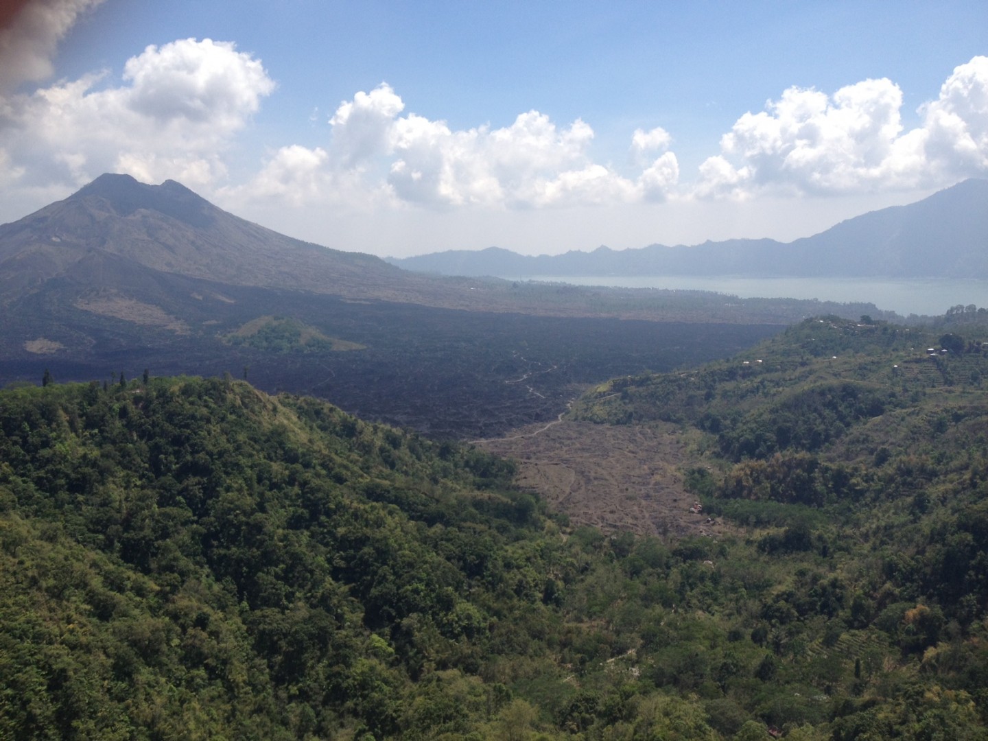
I whipped out my iPhone whilst downing a few bananas and donning my cycling gear and took a snap of Mt Batur.
I must say, the perspective and up to date detail in the Google Earth rendition is absolutely astounding!!!
Sure the ridge line on the horizon is quite smoothed compared to reality, and the clouds on the right hand side of the Google Earth rendition of the perspective makes the South side of the Caldera appear to be covered in snow (which at close to 30 C / 85 F and 90% humidity that just isn’t going to happen any time soon) but for planning a landscape shoot or even a shoot of a building or some other structure, being able to visualize a remote location before arriving might make the difference when time is of the essence, especially in a pre-dawn shoot or a commercial shoot when you won’t have the opportunity to shoot again tomorrow pre-planning can make all the difference!!
